Schluchtensteig
Along Wild Trails Through the Gorges of the Black Forest 🌲💧🥾
Roaring waterfalls, mysterious gorges, and pristine forests where nature still sets its own rhythm. The Schluchtensteig in the Southern Black Forest takes you into a fascinating landscape full of contrasts. Over roughly 120 kilometers, you will hike from Stühlingen on the Swiss border all the way to Wehr, discovering one of Germany's most impressive natural landscapes 🌿. Between steep rock faces, rushing mountain streams, and scenic high-altitude trails, a hiking journey awaits you that holds new surprises with every step.
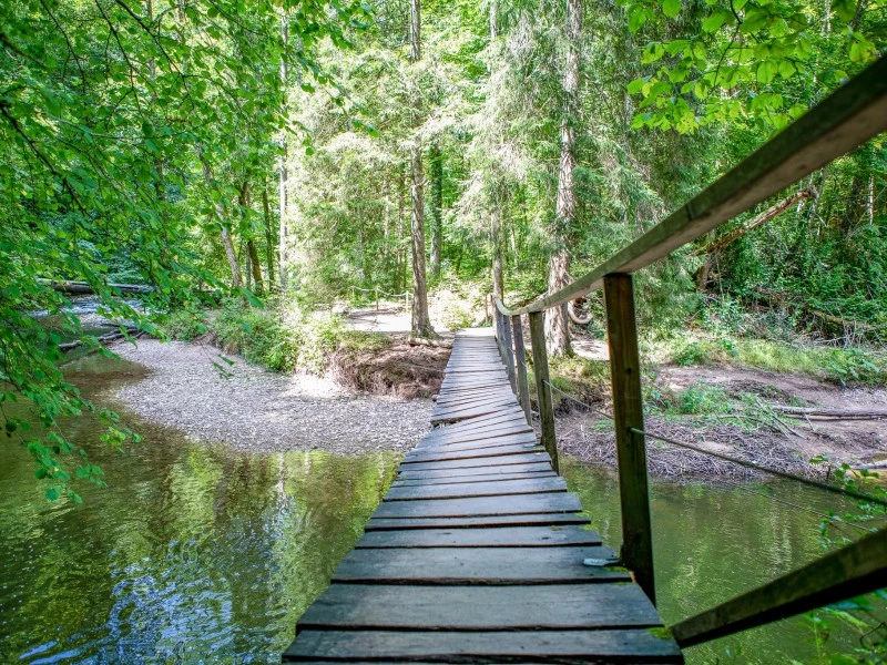
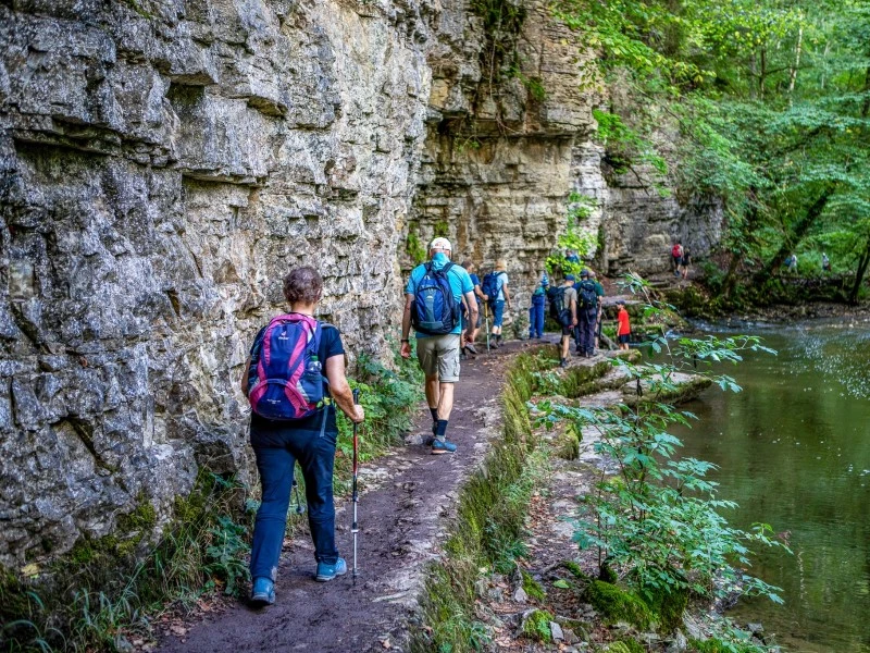
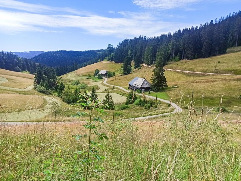
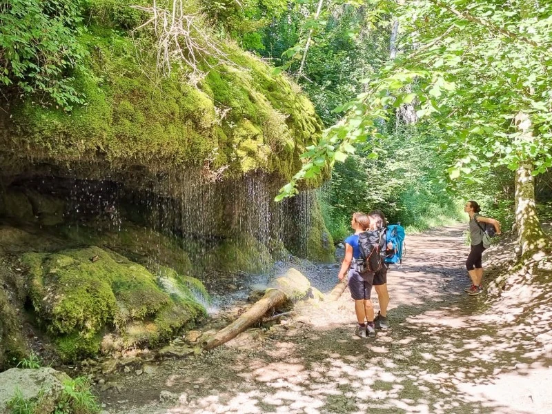
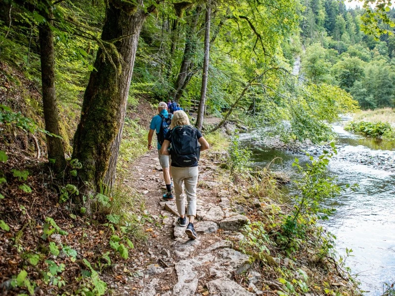
Right from the start, the Black Forest reveals its wild side. Narrow forest paths wind through the jungle-like Wutachflühen, passing moss-covered rocks and deeply carved valleys 🌲. With a bit of luck, you might even spot the historic Sauschwänzlebahn steam railway as it snakes its way along its winding route through the countryside 🚂. A true highlight is the famous Wutach Gorge (Wutachschlucht), where the river has carved deeply into the rock over millennia. Towering cliff walls, small waterfalls, and lush vegetation create an almost fairytale-like atmosphere that delights every nature lover 💦.
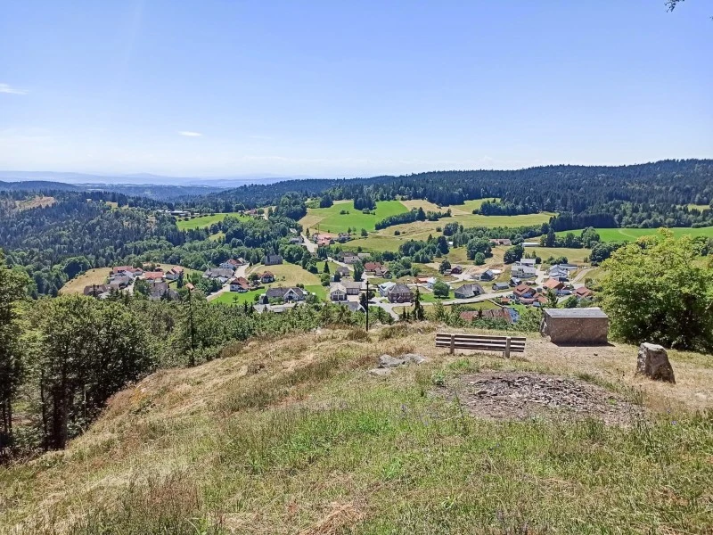
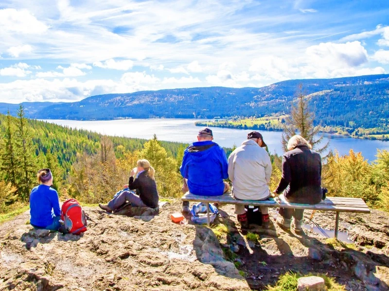
Yet the Schluchtensteig offers far more than its wild water worlds. Time and again, the trails climb up to sunny heights, pass through tranquil forests, and lead past idyllic natural spots. Around the legendary Räuberschlössle ruins and the romantic streams of Rötenbach and Haslach, you will experience the unspoiled beauty of the Black Forest 🍃. Particularly breathtaking is the view from the Bildstein rock outcropping overlooking the deep blue Lake Schluchsee. On a clear day, the panorama stretches all the way to the snow-capped peaks of the Alps ⛰️.
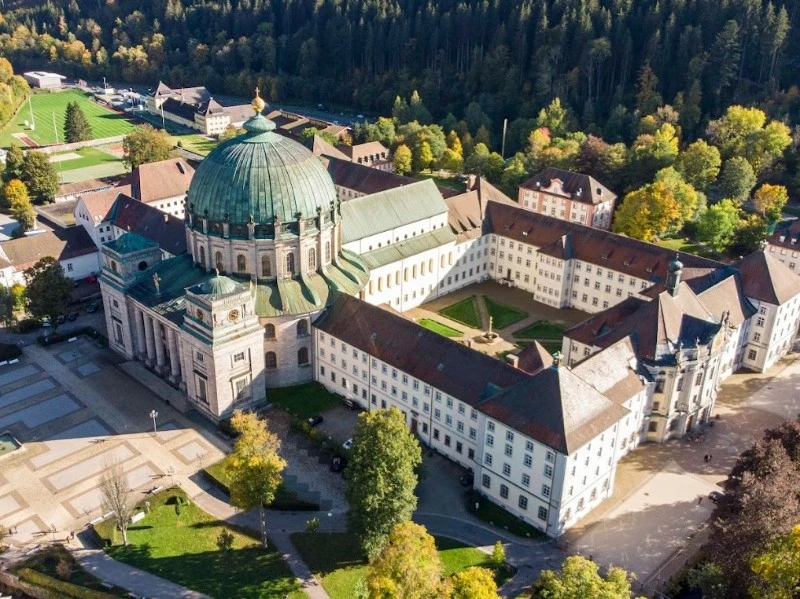
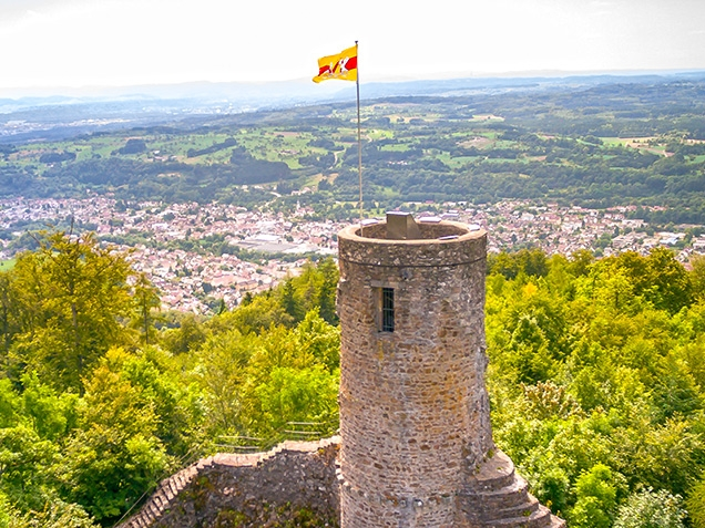
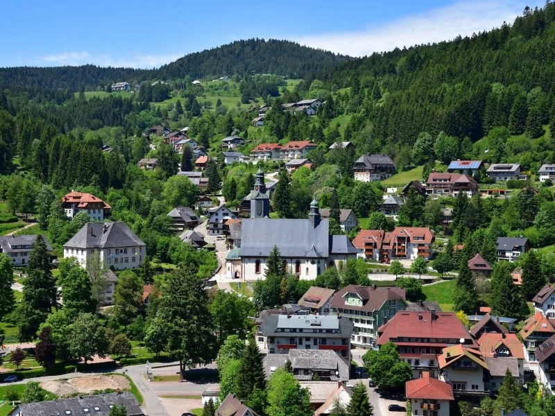
This hiking tour also holds a few cultural surprises in store. In the charming town of St. Blasien, the imposing cathedral with its massive dome awaits you, offering a striking sight right in the middle of the Black Forest ⛪. The trail continues across panoramic ridges and through the idyllic Horbach Heath (Horbacher Heide), opening up magnificent distant views as far as the Swiss Jura mountains 🌄. Passing the observation tower on the Lehenkopf, the path finally leads through the wildly romantic Hohwehra Gorge into the traditional town of Todtmoos.
On the final stage, the Schluchtensteig once again shows off its adventurous side. Narrow trails wind along steep slopes through the unspoiled Wehra Valley (Wehratal). Impressive vistas of the deeply incised landscape open up again and again before you cross the Wehratal Dam to finally reach your destination of Wehr 🏞️. Along the way, quiet resting spots invite you to consciously soak in the special atmosphere of the Black Forest nature.
The six varied hiking stages lead along natural forest tracks, narrow root-covered paths, and occasionally demanding climbs 👣. With daily distances between 18 and 23 kilometers, several steep ascents, and passages along sheer drop-offs, a good level of basic fitness, sure-footedness, and a head for heights are required. In return, you are rewarded with unique nature experiences, spectacular gorges, and unforgettable panoramic views.
The Schluchtensteig is a hiking journey full of authenticity, adventure, and fascinating moments in nature. It is a trail where rushing water, silent woods, and expansive mountain landscapes merge into a truly special experience. Anyone looking to discover the wild beauty of the Black Forest and experience nature with all their senses will find a hike here that stays with them long after the journey ends 💚🥾.
Arrival in Stühlingen
Arrival in Stühlingen by train, bus, or private car. Stühlingen offers public parking spaces where you can leave your vehicle free of charge for the duration of your hiking trip. The nearest train station is Lauchringen, from where buses run to Stühlingen. The town is located directly on the Swiss border within the Southern Black Forest Nature Park. It is best known as the starting point for hiking the Schluchtensteig, though the Southern Black Forest Cycle Path (Südschwarzwald-Radweg) also passes through Stühlingen.
Stühlingen - Blumberg
From the High Rhine, the trail climbs up onto the Baar plateau. The ascents are not to be underestimated, but they are rewarded with impressive views. With a bit of luck, the historic Sauschwänzlebahn steam railway will cross your path during the first part of the stage. Later, narrow, root-covered paths lead through the jungle-like Wutachflühen toward Blumberg. Due to its history, the townscape is unusual: Blumberg features characteristics of a mining town reminiscent of places in the Ruhr region. Blumberg is a state-recognized health resort, serves as the starting point for numerous hikes, and lies directly on the Schluchtensteig, Querweg, and WasserWeltenSteig trails.
Blumberg - Schattenmühle
Today, you will immerse yourself deep in the Black Forest gorge world. Between steep, rugged rock faces, the wild Wutach river carves its way through one of Baden-Württemberg's oldest nature reserves. The trail consistently follows the rushing river, with waterfalls splashing and lush greenery all around. Once you arrive at the Schattenmühle, you will have earned a refreshment. To reach your accommodation in Bonndorf, you will hike through the gorgeous Lotenbach Gorge (Lotenbachklamm) to the bus stop (approx. 1.5 km; 30 min); from there, the hikers' bus takes you on a short ride to Bonndorf. The name "Schattenmühle" (Shadow Mill) comes from its deep, "shady" location in the gorge. The first documented mention of the mill dates back to 1596, referencing a "Miller of Göschweiler." Several long-distance hiking trails pass through here, including the Schluchtensteig, the WasserWeltenSteig, and the Querweg.
Schattenmühle - Fischbach
Fischbach - St. Blasien
Hardly have you set off in the morning when one of the tour's finest views awaits you: the vista from the Bildstein rock outcropping down onto Lake Schluchsee, and in good weather, all the way to the peaks of the Alps. During a stop at the Unterkrummenhof inn, you can gaze out over the sparkling waters of the vast Lake Schluchsee. Varied forest paths then lead you onward to St. Blasien. Once there, you should definitely take a look inside the cathedral with its imposing dome. St. Blasien is famous for its cathedral and also lies directly on the Schluchtensteig and Albsteig trails.
St. Blasien - Todtmoos
Todtmoos - Wehr
Departure or extension
Departure or extension
Day 1
Arrival in Stühlingen
Arrival in Stühlingen by train, bus, or private car. Stühlingen offers public parking spaces where you can leave your vehicle free of charge for the duration of your hiking trip. The nearest train station is Lauchringen, from where buses run to Stühlingen. The town is located directly on the Swiss border within the Southern Black Forest Nature Park. It is best known as the starting point for hiking the Schluchtensteig, though the Southern Black Forest Cycle Path (Südschwarzwald-Radweg) also passes through Stühlingen.
Day 2
Stühlingen - Blumberg
From the High Rhine, the trail climbs up onto the Baar plateau. The ascents are not to be underestimated, but they are rewarded with impressive views. With a bit of luck, the historic Sauschwänzlebahn steam railway will cross your path during the first part of the stage. Later, narrow, root-covered paths lead through the jungle-like Wutachflühen toward Blumberg. Due to its history, the townscape is unusual: Blumberg features characteristics of a mining town reminiscent of places in the Ruhr region. Blumberg is a state-recognized health resort, serves as the starting point for numerous hikes, and lies directly on the Schluchtensteig, Querweg, and WasserWeltenSteig trails.
Day 3
Blumberg - Schattenmühle
Today, you will immerse yourself deep in the Black Forest gorge world. Between steep, rugged rock faces, the wild Wutach river carves its way through one of Baden-Württemberg's oldest nature reserves. The trail consistently follows the rushing river, with waterfalls splashing and lush greenery all around. Once you arrive at the Schattenmühle, you will have earned a refreshment. To reach your accommodation in Bonndorf, you will hike through the gorgeous Lotenbach Gorge (Lotenbachklamm) to the bus stop (approx. 1.5 km; 30 min); from there, the hikers' bus takes you on a short ride to Bonndorf. The name "Schattenmühle" (Shadow Mill) comes from its deep, "shady" location in the gorge. The first documented mention of the mill dates back to 1596, referencing a "Miller of Göschweiler." Several long-distance hiking trails pass through here, including the Schluchtensteig, the WasserWeltenSteig, and the Querweg.
Day 4
Schattenmühle - Fischbach
Day 5
Fischbach - St. Blasien
Hardly have you set off in the morning when one of the tour's finest views awaits you: the vista from the Bildstein rock outcropping down onto Lake Schluchsee, and in good weather, all the way to the peaks of the Alps. During a stop at the Unterkrummenhof inn, you can gaze out over the sparkling waters of the vast Lake Schluchsee. Varied forest paths then lead you onward to St. Blasien. Once there, you should definitely take a look inside the cathedral with its imposing dome. St. Blasien is famous for its cathedral and also lies directly on the Schluchtensteig and Albsteig trails.
Day 6
St. Blasien - Todtmoos
Day 7
Todtmoos - Wehr
Day 8
Departure or extension
Departure or extension
Requirements for hikers
Summary
- Total approx. 120 km over 6 hiking days
- 7 nights
- Breakfast
- Luggage transfer
- Travel documents and GPS data
- Service hotline
- €889 per person in a double room
- €1,049 single room


Facts About the Schluchtensteig
- The Schluchtensteig is located in the Southern Black Forest in Baden-Württemberg
- The long-distance hiking trail leads from Stühlingen to Wehr
- Certified Quality Trail "Wanderbares Deutschland"
- Member of the Top Trails of Germany
- The route crosses the Southern Black Forest Nature Park
- A total of seven gorges characterize the hiking trail
- Highest point at Krummenkreuz at approximately 1,147 meters
- Around 45% of the route runs along natural, unspoiled paths
- Well-known highlights include the Wutach Gorge (Wutachschlucht), Lake Schluchsee, and St. Blasien Cathedral
- The Schluchtensteig was opened in 2008